
Measured Building Survey
At Da Vinci Engineering, we take pride in delivering comprehensive Measured
Building Surveys that offer an accurate and detailed assessment of your
building's physical dimensions and characteristics.
Our surveyors are equipped with years of experience and expertise, ensuring that
all aspects of your building, both its interior and exterior, are meticulously
measured and documented. This includes recording the layout of rooms,
positions of doors and windows, ceiling heights, structural elements, and
architectural details.
The collected data are then processed with the aid of specialized software,
allowing us to generate precise 2D floor plans, elevations, and 3D models of your
building. These results serve as invaluable resources for various purposes,
including architectural design, renovation, space planning, and legal
documentation.
We understand that every project is unique, and our Measured Building Surveys
cater to diverse needs in the construction and property industries. Whether you are
planning a renovation, designing a new space, or require precise data for legal or
planning purposes, our surveys provide you with a detailed and accurate
representation of your building.
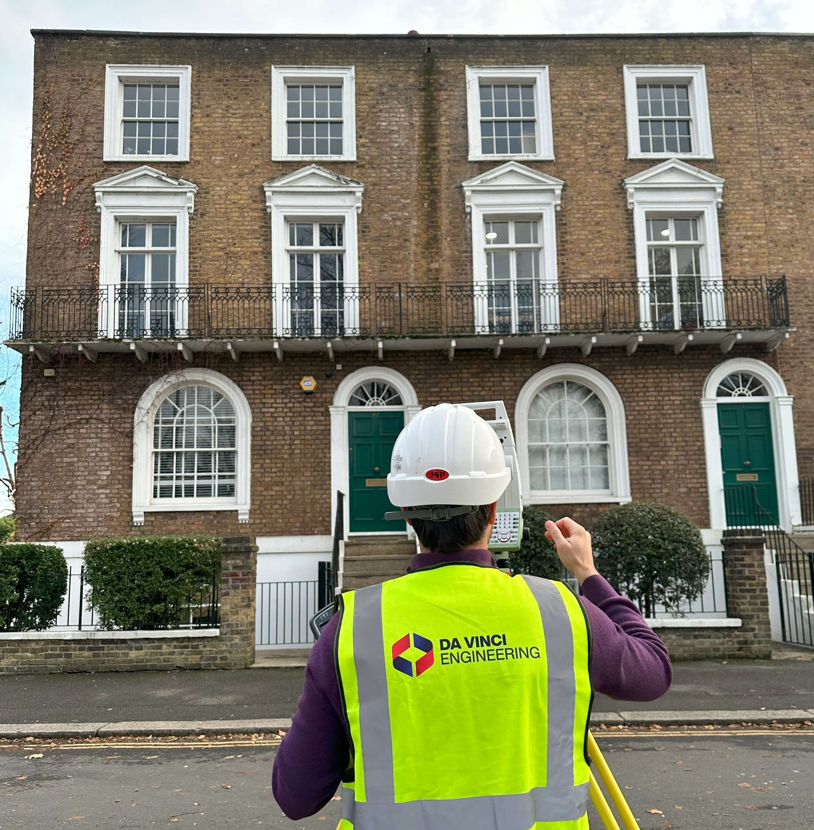
Surveying the building
A Measured Building Survey is a comprehensive assessment of an existing structure's physical dimensions and characteristics. It involves detailed measurements and data collection of all aspects of a building, both its interior and exterior. This survey is typically conducted using laser measurement tools and precision instruments to ensure accuracy.During the Survey, a team of experienced surveyors will record various features, including the layout of rooms, door and window positions, ceiling heights, structural elements, and any architectural details. The data collected is then processed using specialized software to create precise 2D Floor Plans, Elevations, and 3D Models of the building. Measured building surveys are essential for a wide range of purposes, such as architectural design, renovation, space planning, and legal documentation. They provide a detailed and accurate representation of the building, serving as a valuable resource for various professionals in the construction and property industries.
Efficiency and Accuracy
Measured Building Surveys can be conducted using both Total Stations and 3D Laser Scanners. These advanced surveying tools are essential for capturing precise measurements and data in an efficient and accurate manner.Total stations are optical and electronic instruments used to measure angles and distances. They are particularly useful for capturing detailed dimensions and positions of various structural elements within a building. Total stations work by emitting a laser beam to a reflector or a 3D prism placed at specific points in the building, allowing for accurate distance and angle measurements. This data is then used to create detailed floor plans and elevation drawings.
3D laser scanners, on the other hand, offer a more rapid and comprehensive method of capturing building data. They use laser technology to generate highly detailed 3D Point Clouds of the building's interior and exterior. This data can be processed to create 2D plans, 3D models, and other representations of the building, providing a thorough and precise overview of its characteristics.
The choice between total stations and 3D laser scanners often depends on the project's specific requirements, budget, and time constraints. Both methods are highly effective for conducting measured building surveys and are widely used in the industry.
Georeferencing Measured Building Surveys
Measured building surveys can be related to either Ordnance Survey (OS) national grids or local grids of coordinates, depending on the project's requirements and the location of the building. Here's a brief explanation of how these grids are used.Ordnance Survey (OS) National Grid: In the United Kingdom, the Ordnance Survey National Grid is a standardized coordinate system used for mapping and surveying purposes. It provides a consistent reference framework for geographic data. Measured building surveys can be related to the OS National Grid by specifying the grid coordinates for various survey points within a building. This allows the survey data to be accurately georeferenced and integrated with other geographical information.
Local Grids of Coordinates: In some cases, especially for projects within a specific region or development area, a local grid of coordinates may be used. This local grid is tailored to the project's location and requirements. Measured building surveys can be related to a local grid of coordinates by defining the grid's origin and orientation within the building. This is useful for projects where the OS National Grid may not be the most practical reference system.
The choice of whether to use the OS National Grid or a local grid of coordinates depends on factors like project location, data integration needs, and survey specifications. At Da Vinci Engineering we can provide the necessary expertise to ensure that the survey data is correctly related to the chosen coordinate grid.
Cost
The cost of our 3D Laser Scanning services can vary based on a wide range of factors, including the size and complexity of your project.At Da Vinci Engineering, we are committed to offering cost-effective solutions that match your unique needs. Contact us to discuss your project in detail, and our team will provide you with a personalised quote that aligns with your budget and requirements.
CONTRIBUTING TO YOUR PROJECT SUCCESS
If you need a professional surveyor, do not hesitate. Contact us today for a free quote!
Request A Quote
Da Vinci Engineering ©
All rights reserved
Company No: 15139478
VAT No: 451161328